
 Feb
14
Feb
14
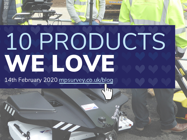
10 products we love
- February 14, 2020
- 0 Comment(s)
Valentine’s Day is upon us and as you know, our product specialists are passionate people. So for all those who love technology, they’ve decided to pick out the 10 products they’re head over heels with.
BLK2GO
The BLK2GO is a truly innovative laser scanner. Leave the tripod behind with this award-winning handheld scanner and capture your environment in real-time 3D with no obstructions. This product will become available to hire from M&P Survey very soon and our team are excited to get their hands on it.
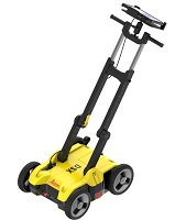
Stream C
If you’re interested in cutting time spent on utility surveys by up to 4 times, this advanced ground-penetrating radar solution is the one for you. Stream C provides the real-time mapping of underground utilities thanks to a massive array of antennas. Increased accuracy means cables and pipes can be located with survey-grade precision. Stream C has landed.
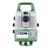
TS16

If you want access to the world’s first and most comprehensive self-learning total station, you want the Leica TS16 – now with AutoHeight function. This total station automatically adjusts to new environments and conditions and will lock onto nothing but your target. If you’re still using last generation technology, it’s time to upgrade.
DD SMART Utility Locators
Enhanced tracing capabilities and an intuitive, user-friendly package are enough to earn the DD220 and DD230 cable locators a place in this list. With bonus features that include Bluetooth connectivity and on-board health check and video user guides, this is the superior cable avoidance tool. Don’t just take our word for it – arrange a no-obligation trial and see for yourself.
RTC 360
If you’re ready to enhance your laser scanning workflow, the fast, agile and precise RTC360 is the laser scanning solution you’ve been searching for. It allows you to generate accurate 3D ![]() representations while managing project complexities. It’s counterpart software, the Cyclone FIELD 360 app, makes it possible to examine scan data on-site.
representations while managing project complexities. It’s counterpart software, the Cyclone FIELD 360 app, makes it possible to examine scan data on-site.
iCON
iCON is completely transforming construction workflows. This software facilitates the move from traditional setting out to digital layout. It increases efficiency while providing the higher levels of accuracy demanded by the modern site engineer. The future of construction is here.
Rugby CLA
The right choice for any application: the Rugby CLA possesses the unique ability to adapt to requirements through software upgrades. It is the first construction laser to maximise productivity and performance in this way. Even with a standard model, an upgrade is just a phone call away.
DSX
This detection solution uses GPR to uncover services clearly and effortlessly thanks to the real-time mapping and display of buried utilities. User-friendly software makes this an ideal product for repair and maintenance and civil engineering companies who want reliable utility detection that also boosts productivity. If you want more efficient utility surveys, the DSX should be on your radar.
Tilt-Compensated GNSS
These GNSS rovers allow for quicker and easier surveys and setting out than ever before. Tilt compensation means there’s no need to hold the pole vertical. The GPS 70 T and GS18 T are also fully calibration-free, so they’re ready to go when you are. What’s more, you can enjoy these perks without compromising on accuracy thanks to the latest innovations in GNSS technology. The GS18 I adds imaging power.
MS60
To meet modern demands, Leica Geosystems introduced the multi station, combining key total station and laser scanner features into one instrument. You can have it all; survey and scan with the MS60. Stay tuned to find out how to become a Multi Surveyor.